
- This event has passed.
October 5th, Monday, Deadline to comment on Roby Forest Management Project Environmental Assessment, BHNF
The USDA Forest Service has completed analysis of the Roby Forest Management project. A preliminary Environmental Assessment is now available for review and comment.
Comments are due on October 5, 2026.
Information may be found at https://www.fs.usda.gov/r02/blackhills/projects/293810. Submit comments by any of the following means:
- https://cara.fs2c.usda.gov/Public/CommentInput?Project=293810
- U.S. mail or hand-delivery: Roby Project, Hell Canyon Ranger District, 1019 N. 5th St., Custer, SD 57730
- Fax: 605-673-9208
Project is West of Custer, South Dakota, along the Wyoming state line
Preliminary Environmental Assessment:
https://usfs-public.app.box.com/s/9pxw99pbbsb61xvw9ks47hxhjckqvewk/file/2446543261312
Maps:
https://usfs-public.app.box.com/s/9pxw99pbbsb61xvw9ks47hxhjckqvewk/file/2446487630248
https://usfs-public.app.box.com/s/9pxw99pbbsb61xvw9ks47hxhjckqvewk/file/2446490747586
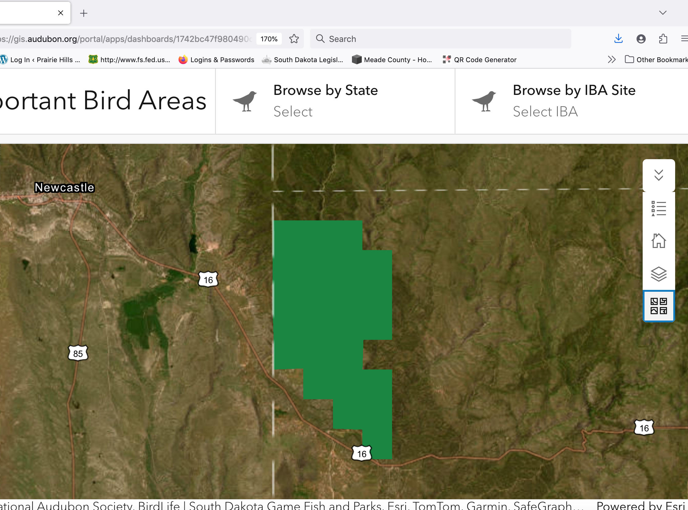
The Roby project overlaps the Mountain Mahogany Shrubland Important Bird Area, recognized by the National Audubon Society. This IBA holds most of South Dakota’s mountain mahogany shrubland, in Boles, Roby, Redbird and Buck Horn Canyons along the Wyoming line. Its dry slopes of mountain mahogany and skunkbrush under an open ponderosa pine canopy support western birds that are rare or absent elsewhere in the state. These include most of South Dakota’s known breeding population of Virginia’s Warbler, isolated more than 200 km from the next nearest population, along with the western Blue-gray Gnatcatcher and the Black Hills’ own white-winged Dark-eyed Junco. South Dakota Game, Fish and Parks ranks Virginia’s Warbler as Imperiled and warns that this isolated population “may be vulnerable to controlled burns.” Yet the Forest Service’s Environmental Assessment never mentions the IBA or these birds. It proposes removing conifers, including commercial-size trees, from 4,698 acres of shrubland, and prescribed burning across nearly the entire 49,000-acre project area, with no protections for the nesting season. By our estimate, about 85% of the IBA lies inside the project boundary, and the Fanny/Boles Research Natural Area, set aside for its mountain mahogany, sits within both. For more, read PHAS’s comments- we will provide link after they are finalized. You can go to the NAS, nationwide IBA web page https://www.audubon.org/important-bird-areas, look for State of SD maps and reports.
PHAS is working on a comment letter and will post the link to that once they are final and sent to FS.
Quote from draft EA:
“Summary of Proposed Action
See Figure 1 (p. 5). Detailed descriptions can be found starting on p. 8.
Commercial timber harvest is proposed on up to 9,677 acres. Prescriptions would include
thinning, regeneration, removal, and improvement cuts. In most areas, logging slash would be
piled and either burned or removed. Where slash is not piled, it would be treated to meet
Forest Plan objectives for hazardous fuels.
Activities that may include a component of commercial timber harvest are proposed on up to
39,059 acres. These activities include thinning of smaller trees, creation of shaded fuel breaks,
and removal of encroaching conifers from aspen stands, meadows, and shrublands. Any
merchantable trees that are cut as part of these activities would be removed and sold. Slash
from cutting smaller trees would be chipped, piled and burned, or otherwise mitigated.
To facilitate timber harvest, approximately one-half mile of new permanent road would be
constructed. Reconstruction of 20 miles of roads would also occur, along with standard
maintenance activities on other roads.
Tree planting would occur on 1,442 acres in areas burned by recent wildfires.
Prescribed fire is proposed across most of the project area. Broadcast burning would occur in
smaller blocks as weather and fuel conditions allow. A detailed burn plan would be prepared
prior to burning. Qualified burn bosses, ignition squads, and holding resources would be
required, along with any other resources the burn boss deems necessary. Contingency
resources would include heavy equipment, additional firefighters, and cooperating agencies.
Burned areas would be monitored until the fire is completely extinguished.
Adjacent to the Fanny/Boles RNA, fuel breaks would be established to reduce the risk of high-
severity fire negatively affecting the characteristics for which the RNA was established. In the
RNA, manual thinning and prescribed fire would be applied to restore natural ecological
conditions. Before implementing any approved management activity in the RNA, a Forest
Service botanist will develop a site-specific RNA management plan.
Low-tech process-based riparian restoration techniques are proposed where stream and
channel conditions warrant. Most streams (97 percent of stream miles) are ephemeral or
intermittent. Even where streams are generally dry, however, there may be opportunities for
restoration, such as repairing headcuts. Exact locations and techniques would be determined
based on field review.
Up to 16 miles of system roads would be closed and removed from the Motor Vehicle Use Map
to reduce damage to soil and water, disturbance of wildlife, and open road density. Various
methods and combinations of methods are proposed, depending on current road condition and
future needs. User-created roads that connect system roads would be closed. Other
unauthorized roads would be closed as the opportunity arises.
Bureau of Land Management (BLM) lands are adjacent to the western edge of the project area.
To facilitate timber harvest on these lands, approximately one-half mile of road would be
constructed and three to four miles of road would be reconstructed.
Maps
Generalized maps are displayed on the next two pages. Detailed maps may be found at
https://www.fs.usda.gov/r02/blackhills/projects/293810“